CEDAR RAPIDS RIVER CORRIDOR REDEVELOPMENT PLAN
Cedar Rapids, IA, USA
Sasaki Associates
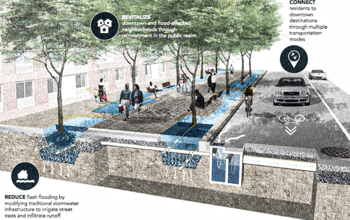
Cedar Rapids is built around the Cedar River, located in the Iowa/Cedar River Basin. The Iowa Flood of 2008 inundated the city, cresting over 10 feet beyond its maximum flood stage; the levees protecting the city were overtopped by almost five feet of water. 10 square miles of the city, including many municipal buildings like city hall, the city jail, and the federal courthouse, were inundated, as well as 5,000 homes. After the flooding had receded, strike teams entered the city and color-coded buildings, evaluating whether they were safe to enter or needed to be demolished. Sasaki was hired to complete a masterplan in phases, with the first phase, a flood management strategy, minimizing future flooding risk through a floodplain greenway to increase connectivity with the river while transforming the 650 parcels that were damaged beyond repair into civic open space that clears part of the 100 year floodplain. Sasaki led a team of consultants and engaged with the United States Army Corps of Engineers to synthesize feedback from the community. In the second phase, the framework for neighborhood reinvestment, a framework was developed specific to each of the nine neighborhoods, which were grouped into three planning study areas across the river, bringing together shared interests across neighborhood boundaries, and framing the conversation in terms of pedestrian and transit connections, as well as open spaces and diverse neighborhoods. The community engaged in over 6,000 hours of community planning. After the conclusion of the River Corridor Redevelopment Plan, Sasaki engaged in a masterplan for downtown parks and recreation spaces.
2010
220 acres
727 feet above sea level
2010
220 acres
727 feet above sea level
tags: freshwater flooding, absorption, restoration, adaptation, anonymous adaptation, resilience, ecological, government-driven, masterplan, design project, flooding, stormwater, displacement, densification, North America, Sauk, Meskwaki, Iowa, Nearctic, Grassland
References:
Siders, A.R. “Social justice implications of US managed retreat buyout programs.” Climatic Change 152 (2019): 239-257.
Tate, Eric, Aaron Strong, Travis Kraus, and Haoyi Xiong. “Flood recovery and property acquisition in Cedar Rapids, Iowa.” Natural hazards 80, no. 3 (2016): 2055-2079.
Links:
http://www.cedar-rapids.org/local_government/departments_a_-_f/community_development/index.php
https://www.thegazette.com/subject/news/cedar-rapids-projects-developments-2020-20200113
https://www.sasaki.com/projects/cedar-rapids-riverfront/
https://www.sasaki.com/projects/cedar-rapids-river-corridor-redevelopment-plan-2/