*CHARLES RIVER FLOOD CONTROL PROGRAM | Primary Case
Boston, Cambridge, Somerville, MA
USACE
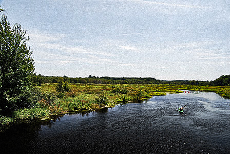
The Charles River runs 80 miles from Hopkinton into Boston Harbor, with thousands of acres of wetlands along the river that appear dry and store floodwaters in times of excess participation. The river is dammed between Charleston and the North End of Boston, which provides flood protection to 2,440 acres of urban property along the banks of the Charles River in Boston, Brookline, Cambridge and Back Bay. The Charles was first dammed in 1910 to prevent tidal flooding of sewers and drains along the lower Charles, and a second dam was built in 1972. Despite the dam, the wetlands along the river’s course are critical to ensure that development is not flooded, and the land adjacent to the Charles River in the Charles River Natural Valley Storage Area (CRNVA) has been continuously purchased since a 1972 study was published that cited the need to protect further areas from development. The United States Army Corps of Engineers (USACE) purchased its first acres in May 1977 and continued to acquire land up to September 1983 at a cost of over $8.3 million across the watershed of the Charles River, which covers 307 square miles. These protected lands are used for recreational purposes as well as fish and wildlife management. The success of the CRNVA project have been quantified at over $11.9 million in damage due to flooding, as well as recreational benefits.
30 feet above sea level
tags: freshwater flooding, retain, absorption, fortification, resilience, engineering, government-driven, masterplan, flooding, watershed degradation, landscape reclamation, Massachusetts, Wampanoag, Nearctic, Temperate Forest
References:
United States Army Corps of Engineers. “Charles River Natural Valley Storage Area.” USACE. Accessed July 21, 2020. https://www.nae.usace.army.mil/Missions/Civil-Works/Flood-Risk-Management/Massachusetts/Charles-River-NVS/ target="_blank">https://www.nae.usace.army.mil/Missions/Civil-Works/Flood-Risk-Management/Massachusetts/Charles-River-NVS/
United States Army Corps of Engineers. “Charles River Dam Local Protection Project.” USACE. Accessed July 21, 2020. https://www.nae.usace.army.mil/Missions/Civil-Works/Flood-Risk-Management/Massachusetts/Charles-River-NVS/
Kousky, Carolyn. “The Economics and Politics of ‘Green’ Flood Control: A Historical Examination of Natural Valley Storage Protection by the Corps of Engineers. Resources for the Future Discussion Paper 14-07 (2014).
Cheng, Chingwen, Y.C. Ethan Yang, Robert Ryan, Qian Yu, Elizabeth Brabec. “Assessing climate change-induced flooding mitigation for adaptation in Boston’s Charles River Watershed, USA.” Landscape and Urban Planning 167 (2017): 25-36.
Links:
| https://www.arcgis.com/apps/MapJournal/index.html?appid=0bf97d033a8642b18c2e8075d4b5ecfe |